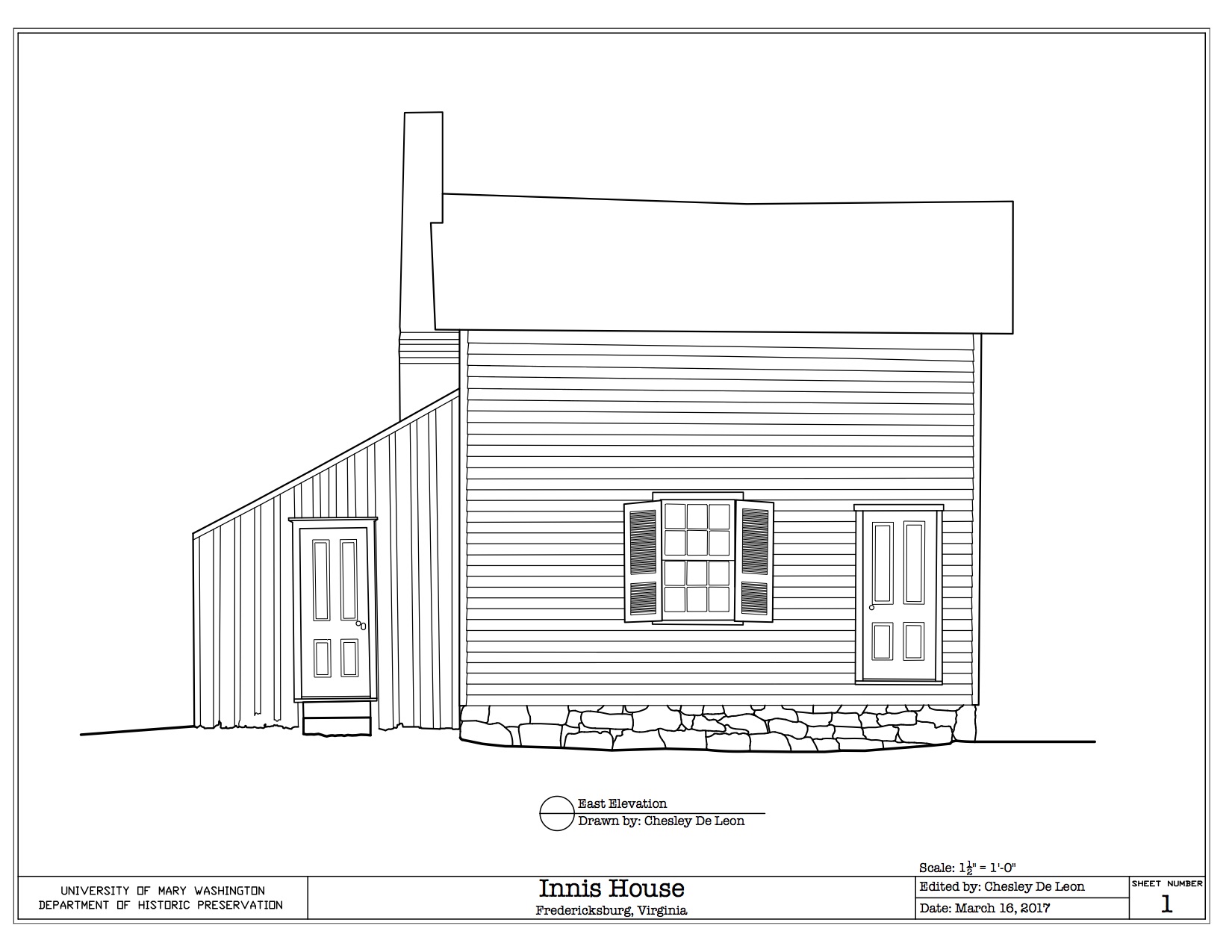

Innis House
Fredericksburg, VA
East Elevation
Spring 2017

The purpose of the assignment was to draw an elevation of a building based off of an image that was rectified by using points taken from a laser scanner. First, a Leica reflectorless total station was set up in front of the assigned structure, the Innis House in Fredericksburg, VA. Then, multiple data points of the building were recorded and collected onto TachyCAD.
Once the points were taken, digital photographs of the structure were rectified using the recorded points and Kubit PhoToPlan software. Finally, the rectified image was used in order to draw the east elevation of the Innis House.
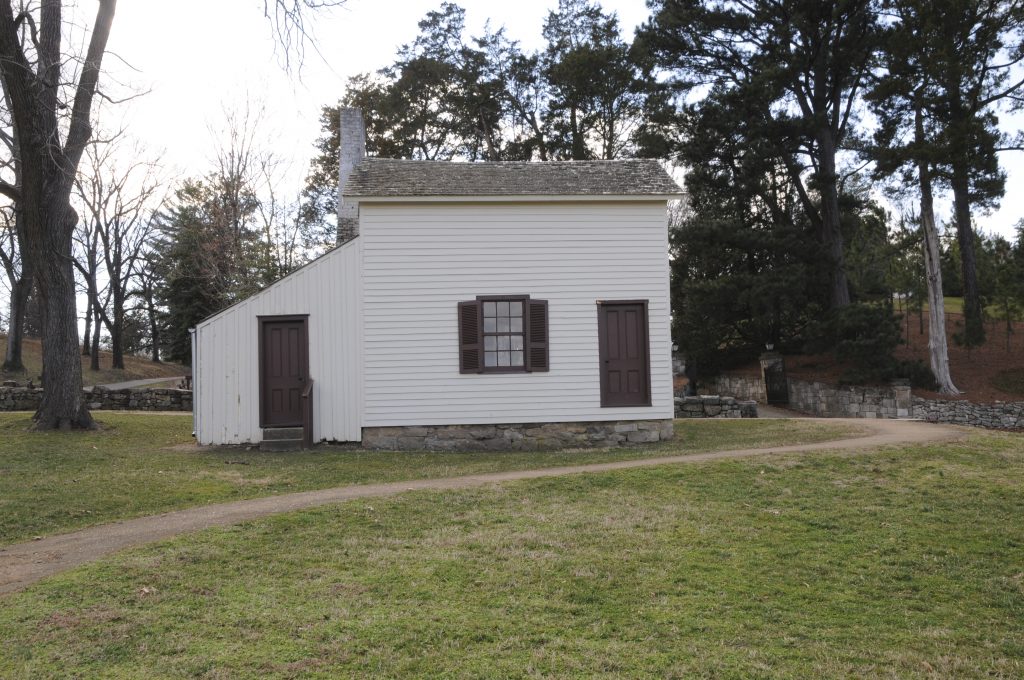
Unrectified Image
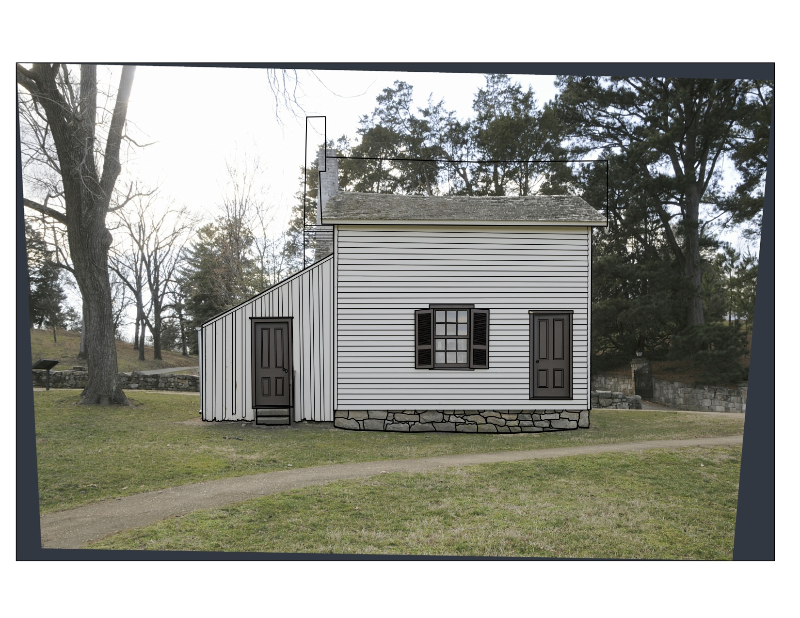
Rectified Image
